Friday, June 14, 2013

Northern Canadian Rockies- Muncho Lake, British Columbia


Northern Canadian Rockies- The Lodge on Muncho Lake, BC.


After driving 500 miles on winding mountain roads that are under reconstruction
 this lodge seemed like an oasis. 

 Things learned about remote high elevation mountain campsites.

(1) The nights freeze even if it is mid-June. It was not uncommon to have 30 degrees by 2-3 am. Being awoken by the cold temperatures the first night was a surprise. I don't like to use heat if not necessary while camping. Here the heat was necessary.

(2) Remote campsites can charge whatever they want for services because the closest services are a 4 hour drive away. Warning to self: Don't let your gas tank get less than half empty or you will be vulnerable to the high cost of gas in the mountains. Or worse, no services and run out of gas in the middle of nowhere.     While sitting in the lobby of the large log cabin of The Lodge using the WiFi to write my blog I heard repeated customer complaints about the cost of gas, meals and even using the shower. The gas in Canada is  measured in litres. There are 3.8 litres of gas in a gallon. The Roadtrek RV has a 31 gallon tank, so that is 118 litres. I usually stop for gas at half empty I will need approximately 60 litres at $1.39 per litre that is $84.00 dollars for half a tank. In the good old USA I could fill my entire tank for between $86 - $100.  At the Lodge the Swiss- German owner of the Lodge has a customer who has no choice but to pay more for gas. The price is not marked at pump and the credit card is left with the front desk. The cost of gas at the lodge is $2.39 per litre or $143 for half a tank of gas. Customers were surprised by the price and I heard many complaints while sitting in lobby. Imagine paying almost $300 to fill your tank of gas. What people didn't know until they left is that just down the road two miles is an old place with gas pump for a dollar less per litre. Luckily, I had filled my tank full only two hours earlier before arriving at the Lodge and the Roadtrek is somewhat gas efficient. I still had 200 miles of gas left before I left the Lodge that morning.

(3) Remote mountain villages do not have auto repair services or even part stores to do it yourself. The rough roads had caused my one wiper blade to stop working. Duct tape to the rescue!  Visibility on a winding mountain road is essential. Canada didn't spend any money on guard rails on steep 2,000 to 3,000 foot drop offs. Many winding roads were above the tall pine tree tops. I imagined falling thru the trees to my demise as my windows were opaque from the heavy rain. On a more pleasant thought, the Lodge is a nice place to stay and I decided to stay three days to rest, do my laundry, enjoy a long hot shower and work on my blog. Think again. The shower costs $1.00 for 4 minutes of shower time. Desperation makes one do desperate things. It was the best $5.00 I had spent on my trip. Still it is irritating to stop in middle of shower to keep feeding the meter.


The Sauna was a nice place to rest in a warm cozy place.
 Of course a Sauna,what else would you expect from a Swiss- German.


My campsite was close to Muncho Lake with  mountains in background.
I especially enjoyed the Paper Birch trees that reminded me of my grandfather's cabin
 on the northern lake of St Helen in Michigan. Maybe Grandpa is responsible
 for my long trip North to Canada and Alaska. Thank you Grandpa Jim.

In the morning I would walk down by the waters edge and watch the Mountain Goats and their babies walk the sheer rock edges in the morning sun. Their white coats and four long legs would show up well against the contrast of the dark rock ledges and dark bark of pine trees.

There was a small fishing boat to fish the cold mountain waters. 
The metal boat was similar to my Grandpa's boat but much nicer.

For the more adventurous there is a small plane available to fly to a remote fishing cabin overnight.
Only $550 for the 24 hour fishing trip. If only Grandpa had a plane! Now that's dreaming.
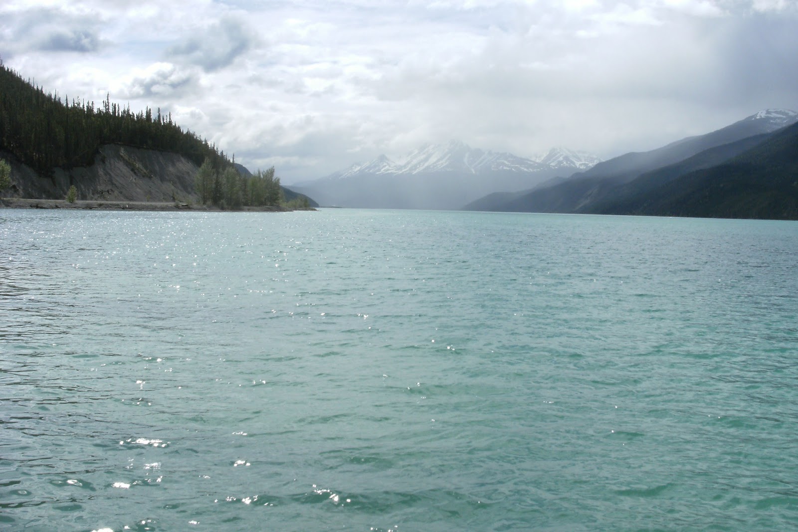


 In the world of clamorous cities and ubiquitous social media, mountain scenes
 like this one seems like the perfect antidote. Filled with this kind of immense scenery
 how can one not become grateful for the years of  life God has given us,
 and know it is up to us to put life in our years. 


 The glacial waters have a turquoise color, reminding me of the beautiful Traverse Bay, Michigan.

 Now I am off to Whitehorse,Yukon Territory. Ever closer to Alaska, just West of my present location.

Tuesday, June 11, 2013

British Columbia- Dawson Creek --------- Mile Zero on Alaskan Highway

 
Have now crossed into British Columbia province from Alberta province.


Mile Zero of Alaska Highway.
It will still be several days before crossing customs check at Alaskan US border.
Our Roadtrek group has split to see different things in area.
Tonight everyone is to get together for a group photo.


Banff National Park, Alberta, Canada


 Banff wecome sign in English and French

Banff is named after Banffshire, Scotland the birthplace of the first settlers who built the Canadian Pacific Railroad through the Canadian Rockie mountains. Banff has an elevation of 4,537 ft making it the highest town in the rockies.

 Banff's downtown shops look like chalets.


My favorite shop is the Candy shop.
 .


Jasper, Alberta - Icefields TransCanadian Glacier Parkway


The Trans-Canadian Glacial Icefields Parkway that leads to Jasper, Alberta backwoods campgrounds.

On June 3rd I started on the 214 mile Glacier Ice Field Parkway drive to the backwoods of Jasper, Alberta. I noticed the 41 degree temperature was dropping to 38 then to 36 degrees as I drove up the mountain.


 Icey Glacier Lake along the Icefield Highway. This scene looks very much like January not June.
Notice the clouds are low. The roads are not icey but there is ice all around the highway.

Ice fields Falls

Whistler's backwoods campground Jasper, Alberta, Canada
This campsite is only a few miles West from Ketchikan, Alaska.
At sunset on first night of camping there was an animal that ran by my window at about 40 mph.
At the Parks Check-in I was warned of Grizzly bears that come out at night.
The animal was an Elk calf and it's mother running from a predator in the woods .
The next morning while walking to the shower facilities I was greeted by the mother Elk, the calf .


Sunday, June 2, 2013

Glacier National Park - St Mary's, Montana


Glacier National Park has spectacular views that will take your breath away.  So will the thousand foot drop offs where Logan's pass traverses the park from East to West.

Glacier National Park has the St Mary's River, the St Mary's Falls and is located in the town of St Mary.
So, why is everything named after St Mary?

Father DeSmet, a Catholic priest, was caught in a heavy snow storm coming off the Divide on the Old Beaverslide trail. When the stormed cleared, the first thing he saw was the face of St Mary. Today many people use the face of St Mary as a landmark to help guide them safely off the mountain.
The face of St Mary appears in the rocks of Single Shot Mountain.


The road into Glacier National Park is called Going-To-The-Sun Road because of the height of the road.
I camped at the Rising Sun campsite, a primitive campsite meaning no water or electric to hook up to and back in the woods with all the wildlife.

The view I had in the morning from my campsite at Rising Sun CG. The rising moon is in the sky.


In the morning a resident black bear met me on the trail. The Park Ranger told me the Rising Sun CG is on the bear walk path to the lake and creek below. I decided to find some other campers to share the bears with and moved to an area with electric and water.


This became a regular occurrence with me in the RV and the bears walking very close.


Glacier National Park.

The St Mary's River.


The St Mary's river as it runs to the town .


Falls in Glacier National Park.

Rapids downstream from the falls

 Mountain Sheep far off on top of the mountain.


Mountain sheep has noticed that I have stopped on side of the road. 

 Sheep is closer but not sure if it is safe to come closer.

The are sheep are so friendly I believe if I opened my door to feed it, it would be in the RV.


This blog is under construction until I can find a strong WiFi signal to complete the job. Moving to Jasper Alberta, Canada tomorrow maybe I can find better WiFi.

Great Falls, Montana - Lewis and Clark Trail


Great Falls, Montana was to be a place to rest up for a while from the long trek from coastal Carolina.

 First I stopped for some free coffee at a Rest Stop along the highway just Southeast of Great Falls. The guy working at the Rest Stop was a Good Sam camper himself and from the area. He told me of the Lewis and Clark Interpretative Center and the Giant Spring nearby where huge trout could be found in a circular flow of fresh underground water bubbling up. This made me curious, no rest for the weary.

One thing lead to another I had found the great falls that Great Falls is named after.


 It was a beautiful day for a walk along the Missouri River.  There I saw a group of boys catching trout from the spring creek coming off the Missouri River and they couldn't get the hook out of the fishes mouth. Who better to ask but a dentist with time on his hands. Dentist to the rescue, fish was saved, boys were happy. Time now to wash my fishy hands.


 This is a smaller falls along the Missouri River.


 This is the fresh water Giant Spring that the boys were catching the trout.


 Water from the Giant Spring form a rapids as the water flows into the Missouri River.


The migration of the Swallows from Capistrano migrate through Great Falls. Some have become residents for the Spring and Summer months.


This Blog is under construction .  WiFi is very hard to find in the mountains since satellite is only way to get WiFi, I have been at Tim Horton's Coffee shop for several mornings now and have little done for the time.

Saturday, June 1, 2013

Devils Tower National Monument


At 5:30 am I hiked to the top of the trail around Devils Tower. It was 45 degrees and very still, the only sound was the wind whistling through the Ponderosa Pine trees. The valley below has a river run through where I camped for the night. The camping was primitive but very peaceful.  Just as the entire park is.

 Devils Tower from the start of the hike to top of trail.


The Northern Plains Indians have a legend that the great bear from the sky has made the vertical scratch marks on the Devils Tower.


There are sacred "Prayer Ribbons" left by the Northern Plains Indians.


Devils Tower is made of Igneous rock (previously molten) from a volcano that had sedimentary rock and soil around the cone of volcano. Over the years the sedimentary  rock and soil eroded away leaving the Tower. The scratch lines are due to the cubic structure of the rock eroding away.  In other areas of Wyoming and Montana can be seen smaller "towers" of rock of similar structure.


View while driving into Devils Tower Monument Park


At the entrance to the park are hundreds of Prairie Dogs and their mounds.
While walking across the Prairie Dog town there was an alarm sounded. The little doggies popping their heads up to look and then ducked back down into their holes. Now I know how "Wack a Mole" was thought of as a game. Sorry little doggies.


Now I am off to Billings, Montana as an intermediate stop on the way to Great Falls, Montana.


Billings has a Rim View of their city as Billings is surrounded by mountains and high ridges on two sides.
When I left for Great Falls, Montana the next morning at 4:00 am the city was all lit up very bright.